Cost-Benefit Analysis
Tidal flooding is one of New York City’s most dangerous future problems. With decades separating the present and the inevitable flooding, the city has an opportunity to bolster its resiliency infrastructure, which can include hard infrastructure, soft infrastructure, and rezoning for resiliency.
Our project evaluates the economic, social, and environmental costs and benefits of converting vacant lots and bought-out land into building soft infrastructure (in this case, salt marshes) to diminish the effects of future tidal flooding in New York City.
Our outcomes have two parts: First, the costs and benefits will be presented through an interactive data visualization tool that our sponsor, the Department of Parks and Recreation, can utilize to inform their future conversion decision processes. Then, we will provide a policy report to NYC DPR.

Providing buy-out suggestions based on the overlap area showed by our NYC Coastal Flooding Planner.

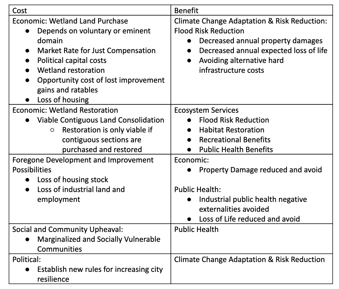
Considering the details of buy-out plan based on cost-benefit analysis table.

Provide a policy report based on Brighton Beach as an example.

Indentify policy plans on increasing city resilience for more specific locations, like Coney Island.


yc3763@nyu.edu

cd2682@nyu.edu

ah4790@nyu.edu

hy1528@nyu.edu